This display features cartographic works selected from the Library's collection of over 1,800 pictorial maps and focuses on the use of this genre in print advertisements by commercial airlines during the first half of the 20th century. On view are several vibrant pictorial “route maps” designed for a variety of international airlines. Each illustrates the delicate marriage of art and commerce in mid-century map making. This display also includes vintage postcards published in the 1940s to advertise the new “La Guardia Field” (LaGuardia Airport), New York City’s longest operating municipal airport.
More Exhibitions
-
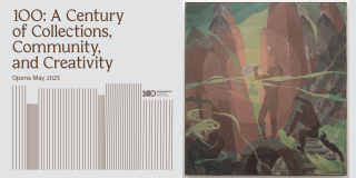
100: A Century of Collections, Community, and Creativity
May 8, 2025–June 30, 2026Schomburg Center for Research in Black Culture100: A Century of Collections, Community, and Creativity will explore the Schomburg Center’s history through the prism of place,…